Monday, September 28, 2015

Time Illusions, 20.4 Miles and Singing to the Bears

Having accomplished a 17 mile hike a few weeks back, I was hungry to up the ante. I made arrangements to cover my two weekend shifts, and after working with a beloved private client from 6:30 am to 7:30 am on Saturday, I set off on what was supposed to be a 42 mile weekend over 2 days.

Realistically, I figured I'd be at Vincent Gap, my starting point, by 10 am. With 20.4 miles laid before me as that day's goal, I figured I could readily cover that in 8-10 hours, putting me at Buckhorn Campground, my endpoint, between 6-8 pm.

Fortunately I'm not a superstitious woman, because if I was, I would've turned back twice. First, Highway 2 was closed through to Wrightwood, which means I couldn't access my starting point from here. After asking a few detailed questions of the forest ranger at the station I stopped in, he told me I could definitely access Vincent Gap via the back way on the 2. Great. This meant, I'd have to back track, pick up the 210 Freeway to the 15 Freeway to the 138 Highway and back on the 2. This would add another 1/2 hour to my trip.

Now I'm a determined mother, and when I want something, dammit, I'm going to go get it. I was so excited about my trip the night before, I'd barely gotten 4 hours of sleep. I cranked up the Delicate Steve tunes and set out on my way. Holy shit! Wouldn't you know it. Both the north and south routes to the 15 were closed, which meant I'd have to drive up the 215 to the 15 to the 138 and back to the 2. I did some quick calculations realizing this would likely mean I'd be hiking in the dark, now a full hour behind schedule, and decided to continue on as planned.

Although it was a scorching 95 degrees in Los Angeles, it was windy and a beautiful 78 at Vincent Gap--the start of the beloved Mt. Baden-Powell trek as well as the High Desert National Recreation Trail. My plan was to summit Mt. Baden-Powell, cross over via the Pacific Crest Trail through Mt. Burnham, Throop Peak, Mt. Hawkins, through Windy Gap and Islip Saddle, then climbing along the South side of Mt. Williamson back to Eagle's Roost picnic area along the 2. As I wanted to ensure water, I would then walk along Hwy 2 for 5-6 miles to Buckhorn Campground, where I planned to stay the night and refuel. Yes! My map reading skills have improved tremendously, and I can identify a campground with the works.

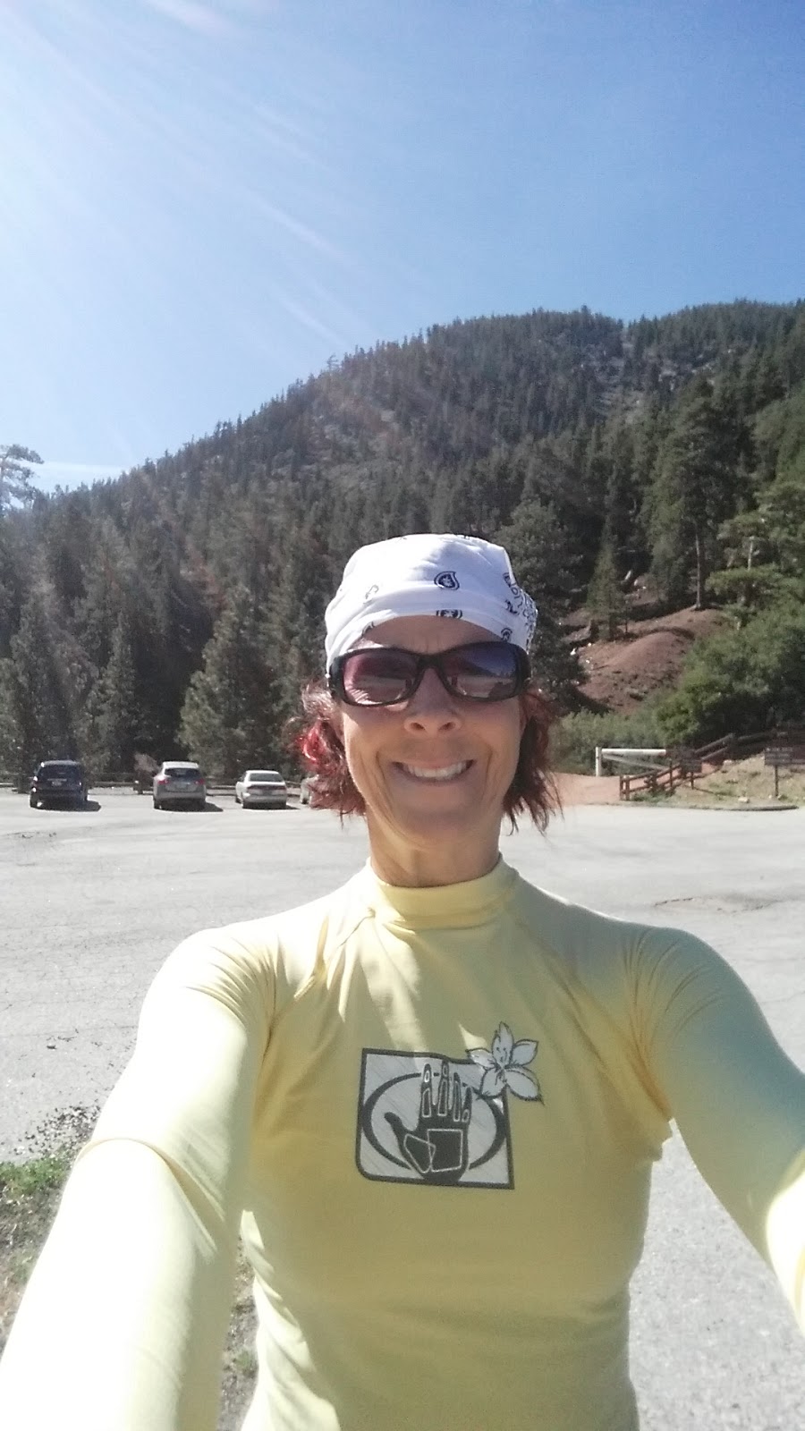
At 11 am precisely, I took my pre-trip selfie and headed up Mt. Baden Powell. Holy shit!! If you want a well-groomed, incredibly beautiful, strenuous (but not particularly dangerous) hike to start your day, the 3000' elevation gain in 3.7 miles up this mountain will have you gasping and realizing that God is.

The wind was crisp, the temperature in the mid to low 70's all the way up. There were so many people! Most folks were day hikers, but everyone asked (since I was wearing a 40# pack) if I was a through hiker on the Pacific Coast Trail. "No, no", I'd tell them, then I'd proudly spout off my plans of my 42 mile 2-day planned journey, to which I still got many oohs and aahs.

I'd decidedly donned my Garmin 305, which I bought 7 years ago, so I could get an accurate read of my pace. Damn you, Andrew Skurka! I am going to catch you one day. His 3 mile per hour average pace loomed largely in my mind. It is a goal I strive for whenever I do this type of training.

I pounded up the mountain, high on life, a wide grin splashed across my face, as I passed loads of young people coming down the mountain from what was obviously an early morning training run. I passed a 70 year old Asian man, who pushed to catch up with me, just so we could chat. He was thrilled to hear of my solo journey. When he told me he was 70, I nearly spit up my Gatorade. Lord! I thought he was 50! I made it to the top of the mountain at a record pace. My Garmin said 5.6 distance and 1:56 time elapsed. Holy shit. I'd gone faster than 3 mph.

Amazed at myself, I found myself excitedly telling almost anyone who would listen. A young woman stopped me to chat and asked to talk to me about my training. An older man at the top shared stories of his adventures and how his desk job had caused him to put on a gut.

It was a beautiful day! I was high on life and grateful, oh so grateful to be alive.

I continued down the other side of Mt. Baden-Powell enjoying the mellow elevation drop. Right about Windy Gap I came across a boy scout troop. The troop leaders couldn't remember which trail lead to Islip Saddle and which one to Dawson Saddle. They were perplexed. I pulled out my handy-dandy Tom Harrison "Angeles High Country" map, which I now carry on every hike, and together we figured it out.  It was a good thing too, because my head was so in the clouds, I would've missed the fork altogether.

I plunged on ahead, working my way what was now down the other side. I was making spectacular time, and I was going to hit camp early tonight. Although I'd originally planned to trap a bird tonight, I realized I'm going to need to be in camp long enough to make that happen, and I won't do it in a public campsite, so I decided to focus on putting some mileage on my skinny legs instead.

There are 4 things never to leave home without when you're backpacking (besides food and water, of course) duct tape, a knife, some cordage and mole skin. I put all of these to the test over the weekend. Right about the top of Mt. Hawkins, my backpack broke. A $30 special from Supply Sergeant army surplus in Burbank, this backpack has seen many miles and much use.  Last weekend, while belly bear crawling under a fallen tree, the top pouch where I keep my food tore off. Solution? Duct tape! Today it donned a silvery sticky duct tape patch which fixed it right up.

Now, at the top of Mt. Hawkins, my strap broke. Awesome! Grab my knife, cut some cordage, tie the two ends together, and voila! It still works. Besides, there's nothing cooler than pulling out a knife to fix stuff when you're a 50 year old woman. I ain't gonna lie. It was cool watching the boy scouts wonder if I was from Mars.

Oh the day was so beautiful! There were loads of amazing plants, but besides chipmunks and gray squirrels, I didn't see too much wildlife. I did stop to eat some Yucca seeds along the way. Did you know that 100% of a Yucca is edible? Did you also know that when it shoots up that giant trunk into the air emitting its seeds, that signals its last year of life? My Survival teacher, Christopher Nyerges is a font of plant knowledge. It's been a blast going to his class at PCC on Friday nights and eating everything from wild mustard to purselane to cactus to wild cherries to carob.

Last week we learned how to make water by putting a clear plastic bag around plants while they aspirate. I always carry a trash bag anyway to act as a pack raincoat in case of rain. Making it a clear bag will now be protocol.

The day pressed on. I kept walking. I saw a beautiful young couple with their dogs between Little Jimmy and Islip. For a moment, I did a double take. They looked from afar like two friends of mine, but their dog gave them away as someone other. It was an Australian Sheepdog. They have a boxer.

Although I was making stellar time, I kept leap frogging the boy scouts. Everything from fixing my pack, to putting tape on my feet to sitting down to eat would eat up the lead I had made on them. Finally, at Little Jimmy campground, we said our final goodbyes, and I headed further down the mountain.

Yes! I had done 17 miles thus far! I had only 3.4 miles to go, and it was a bit before 5 pm. I stopped off the side of the trail to take a pee. I looked again at my Garmin. Funny, usually when I stop, the average pace really changes. I'd noticed it earlier today, but shrugged it off. Now I really noticed it.

Oh my God! Oh my God! I'd had it set for kilos per hour not miles.

Oh. My. Fracking. God.

My heart sunk. I knew what this meant. The illusion of Super Shannon was shattered. I was not that super. And now, I was severely behind schedule. Seventeen kilometers is only 10.5 miles. I hadn't been averaging 3 mph. No. I had been averaging just over two.

Once again STOP. Think. Don't panic. Make a plan.

I knew I had 2.5 hours left of daylight, and I had about 10 miles to go. Think. Think.

PLAN B

My plan was to make it down to Islip Saddle, then reevaluate. When I got there, I had about 1.5 hours of daylight left. I knew I would not make it from there to Eagle's Roost along the trail before nightfall, but at 4.1 miles, I figured I could make over half. I'd camp at the top or hike down in the dark, but I just had to try. Doing 30 miles tomorrow just wasn't in the plans.

I made excellent time huffing and puffing up the nearly 2000' of elevation gain to the top of the trail. It was still daylight, but barely. I felt good! I was going to go for it.

The trail scared me a bit. Even in the daylight, there were sections that strangely resembled Little Fish Fork, my only aborted mission. A 15' drop-off section would've had many of you jumping down in 2-3 fell swoops. Something about loose rock and unstable footing terrifies me. That added 15 minutes to my journey. Fortunately, this was the only spot like that on this section of trail.

Back on the track, the sun set fully. It was pitch black. Donning my super-bright headlamp, I began to sing as loudly as I could, as I'd read being noisy keeps the animals away. "Sing. Sing a song. Sing out loud. Sing out strooooong." Looking around, I half-expected to catch the eyes of a hunter with my headlamp. Instead, I caught dozens of iridescent diamonds on the backs of black mini spiders. These spiders were everywhere. I'd say one every dozen feet or so. They were small, about the size of the top of a thumbtack, legs included. However, on the back of each one was one spot that caught my headlamp as it crossed over their turf. They looked like tiny diamonds in the dirt.

I wondered if they bit. I wondered if animals disliked spiders too.

Recently, while watching an episode of The Last Alaskans, one of the hunters on the show spoke of how almost no animal in nature dies of old age. He spoke of how hunting, in some ways, is the more humane way for these animals to die. Many starve to death or are eaten by other animals.

I realized some probably die from rattlesnake bites. They can't go the nearest hospital for anti-venom like we can.  I wondered if black widows were an issue to animals too, although I have yet to see a widow out here.

Suddenly, a light appeared behind me. I turned around quickly, alarmed. The wind picked up, and it sounded like a motor bike. Frack! Peering behind me, I had rounded a corner, and now the full moon, which was hidden, had literally now popped into view from behind the mountain which had been blocking it. The wind was blowing fairly hard, thus the motor bike sound. Add to that the fact that the temperature was dropping a bit, and literal chills went up my spine. Whew. False alarm. Nothing to see here, lady. Keep moving on.

I pushed forward. John Denver, Sinead O'Connor, Aretha Franklin, Roberta Flack, Eric Clapton, Blind Melon, and the Eurythmics all kept me company. My tired voice cracked as I struggled to humor the bears with my tunes. My light revealed no peering eyes. Safety.

Finally, around 8pm, I reached Highway 2. I was relieved. Although I will hike in the dark for a bit, I don't particularly like it. It's a little unnerving.

Although I knew I would still be in the dark, I was now walking along a lonely stretch of seldom traveled highway. At least I felt safe from animals, but man was exhaustion starting to creep in. I'd made it a point to eat and drink regularly, but I was now 15 miles in, I hadn't slept well all week, and I still had a long ways to go.

I considered hitchhiking, but then I thought against it. This was my 20+ mile day!! I can't throw that out! So when one, then two cars passed, I smiled, waved, and kept moving. After about an hour, the thought of hitchhiking entered my mind again. "Screw it. I'm tired", I thought.

I stuck my thumb out, but neither of the next 2 cars felt comfortable or willing to pick up the likes of me. I was cute, though! I was also probably smelly. My white bandana was pleasantly arranged over my bright red bob. My new pale yellow long-sleeved top I got on sale at Sport Chalet had a happy picture of a hand and a flower. My patterned knee socks even matched my orange gaiters. My friend Maryann would be so proud that I took the time to match and care about my cuteness factor. However, to the average Joe, I probably look like a scary mass murderer, or at the least an unclean hippy.

Finally, even though I knew I was but a half mile from the campsite, I heard one more car. I stuck out my thumb, and to my great surprise, they pulled over. A young Asian couple who both could've been models opened their doors. I told them I was exhausted and that I'd walked 20 miles, and I wondered if they'd mind giving me a lift just around the bend.

I stuffed my beat up black pack into the front seat of what appeared to be a brand new black BMW with a leather cream interior. After cramming my trekking poles in, being careful not to touch anything for fear of ruining it, off we went. Not more than 30 seconds later, we arrived. That 30 seconds saved me 15 minutes. I was grateful.

I walked down the long winding hill to the campground proper. Why is it that every time I go camping, there's that one group who is partying so hard, whooping, yelling, loudly singing who is completely oblivious to the fact that out of 100 campers, they are the only ones doing this, and everyone else is trying to get to sleep?

One thing I've learned, however, from the last few times dealing with this is that kindness works best. After a short discussion, they agreed to call it a night.  Thank the Jesus. I might get to sleep after all.

Being a first-come first-serve site, however, it didn't look good for me. Site after site was packed. I finally picked site #11, set up my tent, then went to the pay box to pay. When I got back to post my ticket on the post, I was horrified to realize my site was already reserved for a group in sites 8, 9 and 10. Looking over, it appeared they were all asleep, so I decided to hope for luck and camp here anyway. I didn't see another empty site.

I ate another Cliff Builder's Bar for dinner along with some macadamia nuts, brushed my teeth, then curled up in my new sleeping quilt and went to bed.

My knees were throbbingly worrisome,  my head hurt, and I was exhausted. It was an excellent day and an excellent adventure. I decided to sleep in and cut the day shorter tomorrow. I really was a bit concerned about my knees at this point.

I'd read two books of long-distance hikers recently. They'd both told of similar tales. That being said, they both told of taking a day off or lightening the journey to give their knees time to heal, so I went to bed making a new tomorrow plan to do just that.


Wednesday, September 23, 2015

Speed Hiking, Tom Sloan and a Large Mammal

Yesterday, I set out late.  I was exhausted going into the day, even though I'd had a rest day the day before, have been eating perfectly, no longer drink alcohol and got plenty of sleep.

I just couldn't shake my lethargy. The only thing I figure may have contributed was another day of 95 degree heat. Nevertheless, a goal is a goal and discipline to do what you intend to do is a reminder of that goal, so I set out to at least get in some sort of hike for the day.

My new found hiking hero is Andrew Skurka. He's a speed hiker, averaging 3 miles per hour over most any terrain. I've been trying this the last few outings, and it's no small feat to accomplish this pace on a mountain.

If there's one trail I recommend you at least do the first mile of anywhere in Los Angeles, it's the back entrance to Mt. Lowe off Mt. Wilson/Red Box road.


The first mile is breathtaking. Large slabs of white rock stand tall on one side of the trail, while you look out over vast wilderness and endless valleys on the other.

There's a tunnel there about 200 feet long, which is pretty cool too. It's cut into the majestic mountainside, and it's pitch black at night.

Just on the other side of that tunnel, if you walk in another 3/4 mile or so, there's an awesome old tower of some sort. I've watched the sun set there before, and I think it would make an awesome place to pitch a tent for the night for an in-town impromptu adventure.

Today I decided to set out for Tom Sloan Saddle. It would be a fairly quick 4 mile jaunt downhill then back up again. Usually the moment I set foot on the trail, my spirits are lifted, I am in magical land, and I am ready! Today, however, I couldn't get out of my head. For about the first 2 miles, I had to write internal gratitude lists, focus on being in the present and put one foot in front of the other.

The sun was blazing hot overhead, but as I've mentioned before, I thrive in hot weather hikes like this! Long sleeves and a white bandana head wrap, alongside massive quantities of Gatorade keep me cool and comfortable. After about 2 miles, I realized I was traveling at a snail's pace, so I picked up my feet a bit, finally got on the adventure train and put some intention into my journey. The trail after about 2 miles becomes a single track trail that crosses dried up creek beds multiple times, involves a fair amount of short hops over shallow ditches where the trail has washed out, and ends up on a super-skinny single track along the bottom, which to me looked like someone had carved it out again only days ago.

It took me 3 hours to travel 4 miles downhill. Terrible!! I considered making the trek to Dawn Mine. According to my map, it would've been another 2 miles down the riverbed. Once again, however, I was only out for a day hike, and although I had cell service, it was now 4:30 pm. I really didn't feel like a nighttime hike today, as I wanted to get to bed early tonight.

That being said, I decided to create an awesome challenge for myself. Usually it takes me, when I am running, about 1/2 the time to get down as it does to get up. Hiking, it's been about a 2:3 ratio, with the uphill taking about 1/3 longer to climb. I decided to see if I could reverse that today, knowing that I dilly dallied all the way down.

The first 1/2 mile or so back up was slow going. The trail was just too iffy in spots, too narrow and too washed out. After that, however, losing the trail was the least of my worries, so I set out to see how hard and fast I could go. I practiced lifting my knees high, taking large steps. I was on fire! I was panting super heavy, my shirt was soaked. I always play a game with myself wherein I'm only allowed to stop every 20-30 minutes, depending upon the heat and the game.

Today I'd only brought two 32 oz bottles of Gatorade and a bottle of water, so I'd have to ration it and supplement it along with the water I'd made today from the one creek crossing filled with the lovely substance of life.  Gatorade to me is my new addiction. When I'm hot out on the trail, I could literally drink a bottle that size every half an hour. That being said, I'm not interested in hyponatremia, nor running out of liquid due to my gluttony, so my Gatorade becomes the way I reward myself when I reach a goal.

I plowed up the hill, pushing hard, seriously labored breathing. At exactly 20 mins, as planned, I stopped. I allowed myself a full 1/3 of my bottle. OMG, heaven! Stopping gives me an opportunity to look around. Today, I looked back down at the bottom of the dried up creek I'd just left. A loud crashing sound made my hairs stand on end. Something large had just run down the opposite side of that creek and had now made its way to its bottom.

For a minute I stood there wondering. It had to be a bear, deer or mountain lion. From the sound it made it couldn't be anything else. I wasn't fearful of the first two. The third one, however, still looms large in my fear-banks. It would be the one of those creatures that could make it's way straight up the hill it had just taken me 20 minutes to criss-cross, if it desired to hunt me for dinner in only a few short minutes. I stood still, listening. No movement. Nothing.

I continued my walk up my path stopping every few feet to listen. Once again, nothing.

It occurred to me that whatever that was, likely was watching me the entire time I was down there, waiting for me to leave. It occurred to me that it was probably as afraid of me as I was of it.

With that thought, I pushed back up the hill. It was unlikely it was coming after me, and if it was, I sure didn't want to think about it.

I did a fair amount of research before I starting traveling out alone. In 30 years, there have only been 4 mountain lion deaths to humans in the Greater Los Angeles Area. There have only been 9 attacks. One of those deaths was indeed to a woman on this very trail.

The likelihood of getting killed by a mountain lion is less than getting struck by lightening, and I figured the likelihood of a lion killing a woman twice on the same trail even less. Besides that, I honestly don't like to waste my head space worrying about dying. I figure if it's going to happen, I ain't going to see it coming. I always carry a super sharp knife on my hip. If something attacks me, I'm going to die fighting. I don't yet own a gun.

The trail switched back over white rock and Yucca, then into forests of Oak and Manzanita. Although I appreciate the shade, the one thing they always bring is bugs--by the dozens. I hate those little stupid flies buzzing around my head. My arm becomes a veritable windshield wiper, back and forth, back and forth keeping the damned suckers out of my eyes and mouth. I hate those things!

I've covered myself in Deet bug spray in the past, and that seems to help, but something about putting massive quantities of poison on my head doesn't seem healthy to me. I vow to research better head wear and wearable mosquito netting, because these suckers have more than once almost ruined my trip.

I keep pushing up the mountain. Each leg is heavy and tired. I force myself to ignore my high heart rate, and I keep pushing at this blistering pace. I arrive about 1 mile out from the top, where the single track turns back into a fire road, and I am amazed. I am literally going to cut an hour off my time, and I'm going uphill! Yeah, man! I love this!

I notice another water tower that I didn't see on the way down snuggled amidst the brush here. Seems someone else thinks camping on top of these is a good idea. It has a small rock tower fire pit built on top of it. Yeah, this one is far better. It's more secluded. No one would ever know you were here.

The other interesting thing about this particular point, however, is that it has an amazing view of the City of Los Angeles. As a matter of fact, I still had cell phone service here!

I pushed the last mile up the hill back through the tunnel, gulping down my last drops of delicious Gatorade. I made the 4 miles back up in 2 hours, for an overall 5 hours put into an 8 mile hike. Terrible! I shouldn't have dawdled so much on the downhill.  I do not know how Andrew Skurka keeps such a blistering pace day after 30 mile day. Well, there's always next time to give it a shot again.

Sweating profusely and swatting miserably at flies, I finish the hike ducking into my car in the hopes of leaving them behind.  Aaaah. You can't get me here, suckers! One or two are now trapped in the car with me, but I don't care. As I pick up speed on the downhill in my car, I roll down the window, and they fly out one by one.

(Update. I wonder about the accuracy of my map. Tuesday I walked 3 miles at a super easy pace around the track at the local high school. I don't see how I could've been walking slower than that--even on the downhill, where I knew I was dawdling. I'll look at using a pedometer in the future to have certainty.)


Saturday, September 19, 2015

Condor Peak and Nighttime Hiking

Last Sunday I decided to challenge myself with my longest hike to date. Even though I knew it was going to be in the 90's weather wise, I couldn't tear myself away from the idea of checking out Condor Peak.

Condor Peak got its name as it used to be a vast nesting spot for the California Condor. These grand birds used to fly over the area in search of dead animals for food. Sadly, none have been seen in this area since before World War II. There have been a handful being reintroduced to the wild in California recently, but unlucky for me, it is in Big Sur, north of the California Mason Dixon line.

Imagine how cool it would've been to be there in the late 1800's searching for gold and watching these amazing birds with a 9 foot wingspan soar above the chaparral coated mountainsides. I figured I'd let my imagination take me to the majesty of what once was.

Nevertheless, the idea of the 8.3 mile (16.6 round trip) hike peaked my interest, and I've realized I do well in hot weather hikes, so I decided to give it a go.

The trail starts off just across from the Vogel Flats parking area off Big Tujunga Canyon Road. Via a maze of long switchbacks, it's only about a 3000' elevation gain overall. This is deceiving, however, as the trail goes up, up then slightly down continually all along the way--to the top gaining elevation until you can look out over all god-kind.

I brought six 32oz bottles of Gatorade and a handful of Cliff Builder's bars and set out early-ish--finally hitting the trail at 11:30 am. As I wrongly assumed there would be no water up there, I also assumed this would mean no bears and few critters, so I didn't bring along my bear spray. Fortunately I didn't need it, but my assumptions definitely turned out to be wrong.

My mission this trip was to collect wild plants. After enjoying my first class of 5 survival courses I'm taking-- this one being on native edible and inedible plants, I decided to both test my knowledge and bring back samples of things I see all the time but couldn't identify.

I collected Manzanita berries, which can be used like aspic, for a thickener. The leaves can be made into a tea. I found a puff ball mushroom, which if it wasn't so dried up would've been entirely edible. Of course there is Yucca absolutely everywhere. I now know how to make rope from its leaves and found out its fruit is also edible. I pulled up what I thought was wild sage, only to learn that it was gypsum weed, a powerful narcotic, and I munched on Toyon berries, which were quite dry--think grape nuts--having lost some of their inherent tart taste. I was surrounded by buckwheat too, which can be used to make a porridge or mixed with more glutenous flours to make things like pancakes.

However, mostly I just walked fast and looked and walked fast some more.

 My secondary mission was to follow the trail on my map and really delve into the topography, discerning what I was in for ahead of time simply by reading the map. This definitely came in handy, as it prevented me from taking a wrong turn and enabled me to make fairly accurate assessments of how much distance I had traveled.

The map did identify two small streams coming off the trail, but the scope of the drought left me assuming they would not still be there. Instead, this is what I pleasantly found. Water in So Cal in September!

Sure we'd had a brief shower earlier in the week, and even a flash flood warning. Perhaps this place was where the rains actually arrived.

The stream wasn't much more than a trickle. However, the lush green plants surrounding it gave away that this place likely provided water to local fauna year round. Eager to once again try out my water purification skills, I gathered as much as the small puddle would allow, dropped in my iodine tablet and set about to wait the 30 mins it takes.


Water in So Cal Mountains 9/13
After the water, which was less than halfway up, the trail got a bit rockier. I was hoping to average 3 miles each hour, but as the clock approached 3:30, I realized I had not yet hit Condor Peak, and I didn't want to hike back in the dark. I could see the peak however, off in the distance, so I decided to press on. I wanted to reach my target no later than 4:30 pm. I had already been hiking for five hours.

The trail book said to expect five false peaks, so I started counting them. After I hit peak number five, I stood atop the hill victorious, only my celebration was short-lived, as I realized I'd mis-counted. I was somehow on peak #4. Condor Peak loomed large just over the next saddle.

Crap! I'd already allowed an extra hour to get here, and by the looks of the trail, I knew it would take me another hour to hit the top of the bird baby, so I decided to call it a day and set back down, hoping to beat the sunset--even if only by a hair.
Condor Peak Just Over There
Realizing I had set myself up for a stiff challenge, I headed back down the trail as quickly as I could. My trekking pole made of burnt wood stood fast, and I made good time. However, somewhere about 2 miles down, I lost the trail. Realizing the sun was about an hour away from setting, and I had easily another 2 hours on the trail, I retraced my steps. Remembering what happened to me at Fish Fork, I did not want to take the chance of being stuck out here at night. Where is the damned trail? I went back up to where I last knew for certain the trail was and for the life of me could not find the path down.

S.T.O.P. This is what every survivalist learns to do when moments like this occur. Don't panic!

S. Stop,. T. Take Note. O. Observe. P. Plan.

I took a deep breath and decided to make a plan. I stood at the end of the path that was now leading nowhere and searched for 10 minutes looking for signs of the trail. Finally, over the gorge on the peak opposite the peak I was standing on, I saw where the trail picked back up. Knowing what I know now, I knew scaling down that mountain then back up it in a straight line would not only be nearly impossible, it would take far more time than it looked like it should.

That being said, I realized it was my best chance, so I set out to switchback down my hill then find a way to climb the other one back to the known path. I thought of what I should do if  I had to stay the night. I realized how foolish it was that I had decided not to bring my 3 oz thermal blanket. I thought of how I would likely burn down the forest should I decide to start a fire around here, and how I couldn't live with myself if I ever were to make that happen. I decided to put all that out of my mind and cross that bridge if I got to it. I knew if I had to, I would find a way.

I know how to make shelter out of what is around me. I know how to make them warm. If I could get through the night, I knew I'd live to tell the tale another day.

I started carving out a trail and not 4 minutes later, I found my lost trail! There must've been a switchback steep corner I had missed somehow, because there it was. Thank the gods! I wasn't much in the mood for bushwacking.

I picked up the pace and set off to see if I could hit the bottom before nightfall. I was completely unafraid. Along the way, I stopped to take a picture of the fairly fresh pile of bear poop I'd seen on the way up there. It was filled with Manzanita berries and was nearly as big as 2/3 of my foot. When I poked it with my stick, it was wet inside. That's how I knew it was fresh.

As I sped down the mountain I thought about how far I've come in such a few short journeys. My first journey had me terrified of animals. Now I was completely unafraid--not unaware, just not afraid.

My senses were peaked, as the daylight retracted from the mountains, and I listened. Nothing. Crickets and cicadas doing their thang. It's funny how they pick up at night. Even the lone few that live in the gym always start singing when the sun goes down.

Around 7:30 pm, it was 100% black. There was no moon out tonight, but my flashlight kept the trail lit. I loved seeing how my body responded when I'd misjudge a trail and start sliding down the slope a bit. I'd jump back to safety. It was instinctual. I loved that.

I remember when I first started doing CrossFit. My coach at the time used to have us run up something called Suicide Hill. Coming down that path scared the bejesus out of me. It was so damned steep! I always loved how he'd just assume we could all do it and challenge us by not backing down.  We all managed to find a way.  I was grateful for that training now.

Quickly, quickly I went down switchback after switchback, revisiting areas that I'd crossed over earlier, grateful I had an easy-to-follow path. No signs of animals anywhere, not even a rabbit, snake or a mouse.

As I rounded the final switchback made passable only by riding on one's butt under thorny chaparral, it was pitch black. The lights from the lone house in the area burned. A motorcycle rounded the corner, slowing to check me out. I'm sure he was just making sure I was okay. All he could see was an unexpected flashlight from afar.

I headed back down the last stretch of trail which followed the highway, then found safety in my car.

This was my longest trek to date.


Tuesday, September 1, 2015

Easy Sunday from Strawberry Peak to Meadow

After last Sunday's harrowing adventure, coupled with my having an early Monday morning client, I was relegated to a day long adventure on Sunday. I opted for Strawberry Meadow and Springs. The name sounded beautiful. It should be about an 8 mile round trip hike, which sounded like a nice Sunday to me.

I was feeling a bit melancholy, but no sooner did I hit the trail than a feeling of utter peace and bliss came over me. I literally said outloud, "I love this!" I can honestly say with abandon that my weekend adventures are like meditation to me. They are necessary to my life. I love my career of coaching. It is fulfilling. I get to help people every day all day all week.


Therefore, when the weekends come along, I do not feel guilty about seeking out solace. I need it to refresh my batteries.

Once again I stopped at the Ranger Station, or rather the Indian Trading Post on Red Box road off the Old 2. The Asian looking fellow with the missing teeth was there to greet me again. He brightened up when I told him I was going to do Strawberry Meadow today. He said, "The Peak? Oh, you've got to do the peak." Not thinking I had time for both today, I smiled and said, "No, just the meadow today. It's too hot."

He told me "Well then, you need one of these maps!" He proceeded to show me a map that he proudly proclaimed was the most accurate map of this area. He had painstakingly put it together himself in his map making program from 4 other maps, changed around bits to make it better and deleted parts of the trail which were no longer correct. It was a lovely map. I paid him $4.00 and set out on my journey.

No sooner did I set foot on the path than I spotted a deer off up the mountain to my left. I'm feeling pretty confident that if I chose to, I could kill enough meat to eat, but I still have no idea how to skin it, butcher it or save it from the ants, bugs and bacteria. If the hunters followed me, they'd never go hungry. I'm 3 for 3 deer in 2 weekends.

I set up on a lovely path filled with mild switchbacks. The views were stunning. I could hear the motorcycles on the road below. I wondered if they looked up if they could see me. I felt on top of the world.

I hike at a fast pace, stopping when I feel the urge to drink in the air, sun and vistas, which is at least every mile or so. I love how every corner reveals a new landscape. I must say, this never gets old to me.

Not too long after I set out, I saw the only snake of the weekend. I realized it was the same kind of snake I saw on my first adventure up on Trail Canyon. From the photos I researched, it appears he was a Northern 3-lined boa. Whitish with black stripes vertically following the length of his body. This one was obviously a baby, but he was brave. He crossed a mere foot in front of my step.

I knew he wasn't poisonous, so I followed him into the leaves with my gaze. I often think about what it must be like to be an animal up here. Each animal has its own challenges. Snakes are limited to the ground. Deer must constantly be on alert. Even mountain lions have it rough. I learned that they kill their prey then cache it nearby in a tree or the like for safekeeping and later meals. I would love to see a mountain lion cache, except not really, as that would mean a lion was nearby.

I wonder how hard it must be to carry a 100 lb deer up a tree.

I once read about a young boy scout who trailing behind his pack was one of the 3 fatalities in 30 years in So Cal history via mountain lion. They found him cached in a tree.

I continued my upward climb, following my excellent map. Enjoying beautiful views.

I revel in being alone up here. I marvel at how the malls are packed, yet I am the only human here on the entirety of planet Earth right now.

I continue up until I reach a fork which clearly divides the road to the peak from the road to the meadow. I see what I mistakenly think is the Peak off to my left. I can clearly see the path as it meanders up and over the ridge. That looks far too close and too doable to pass up, I think. After a few minutes calculating whether or not I have enough liquid and time to do both today, I decide there is no way I can leave this mountain without doing Strawberry Peak as well, so off I set.

As I approach the peak, I see above and further to my left, another higher peak. I know I have been fooled, and I am thrilled by the challenge. I calculate I can get there in 40 minutes. I marvel as I watch a hawk get there in less than 2. The path is awesome. It is clear cut. It is widely used. It is challenging (not for the severely out of shape or feint of heart), but it's not death defying either. Despite liking adventure, I'm not really ready yet for trail blazing. I don't even (yet) own a machete!

I keep following the trail up and over several more false peaks before seeing the ridge that leads to the Strawberry Daddy. I find a sturdy walking stick in the nick of time, and I huff and puff my way to the top in exactly 40 minutes.

What views! I took pictures of all 360 degrees here.
Wow! As I stood on the peak of the highest mountain in the immediate area. I felt literally on top of the world. Shortly thereafter, I was joined by another human. So now there were two of us who chose to come here rather than the mall. Excitedly, I mentioned this to him, but he seemed to want to be alone, so I set out on my trek back down the hill back to the fork heading to the Meadow.

It took me 40 minutes to get up, 10 mins to revel in beauty, and I hoped for 35 mins down. I made it in 36 minutes. Good enough for me, as the downhill is not my favorite. My blackened walking stick friend had proven himself worthy to be a keeper.

I headed down beautiful switchbacks and shady paths. Some were clearly worn away by our recent dual thunderstorms we had back a few months ago. I thought about what the animals do during these. I decided there and then that I will ensure I am camping again the next time one is predicted, as I am fascinated by these prospects.

I see remnants of trees duly burned by the Station Fire everywhere. I am flabbergasted at how quickly and far reaching this fire's path was. Every trail I have been on shows witness to this atrocity. I wonder again about how horrifying it must've been to have been an animal here during that. It is amazing how quickly the forests have come back though. Most of them are only a few feet away from where they once were.

After about an hour, I reach the meadow. It's beautiful and smallish, but it's truly a meadow.
I hike along the path that leads the way to obvious once formerly oft used campsites. They are all overgrown now. Eddie mentioned there is a bonafide Spring here, but any evidence of water here is long gone. I search for remnants of water, but I can find nothing. Again, I marvel at how the animals survive here.

When I was first looking for Trail Canyon I came upon a creek under a bridge off the Old 2. I hiked down, as it looked interesting. This was in May before those rains came. I was thrilled to find a creek. It was about 8 feet wide and about 8 inches deep with water. Immediately I felt a tick dig into my leg.

I'm sure the animals know where all the good watering spots are. Maybe someday I will too.